Check out Fire Insurance Maps Online
Fire Insurance Maps Online (FIMo) is a georeferenced, historical map database for North America. It has the largest collection of full-color Sanborn fire insurance maps, in addition to 19th century collections by Whipple, Parr/Bascome, and others. This resource is useful for researching land-use patterns, building construction details, property ownership, property uses, and other information, as it includes fire insurance maps, real estate atlases, plat books, and other land-use maps. Our subscription includes all 50 states.
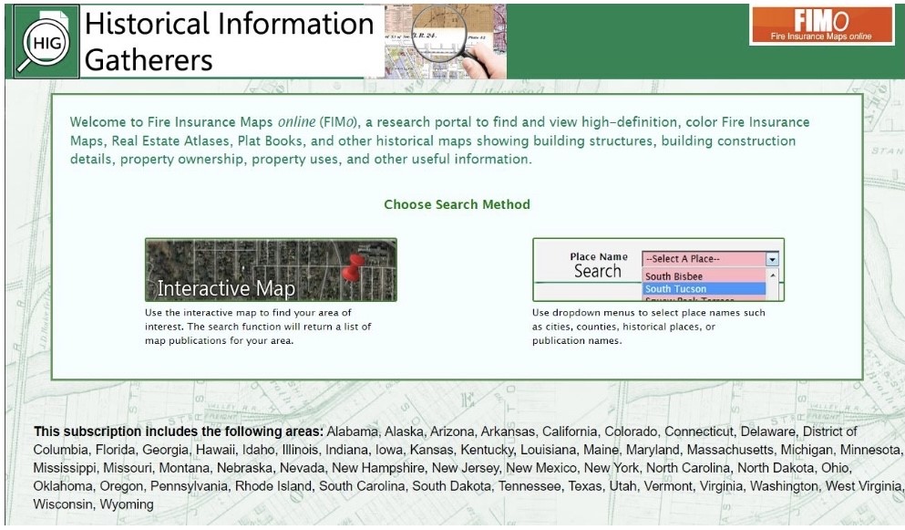
There are two ways to search for maps. With Interactive Map, you can search by address, place (e.g., Gateway Arch), latitude, longitude, or zoom into Google Maps and set a pin. Once an area is selected, a list of relevant maps will be shown that can be sorted by year. When you select a map (‘Show’), the historical Index Map sheet will overlay onto a modern Google street map, allowing you to identify relevant map sheets to view. When you click on the name of the publication, a new window will open where you can open on the full-resolution map sheet. Another option is to browse for maps by city using the Place Name Search.
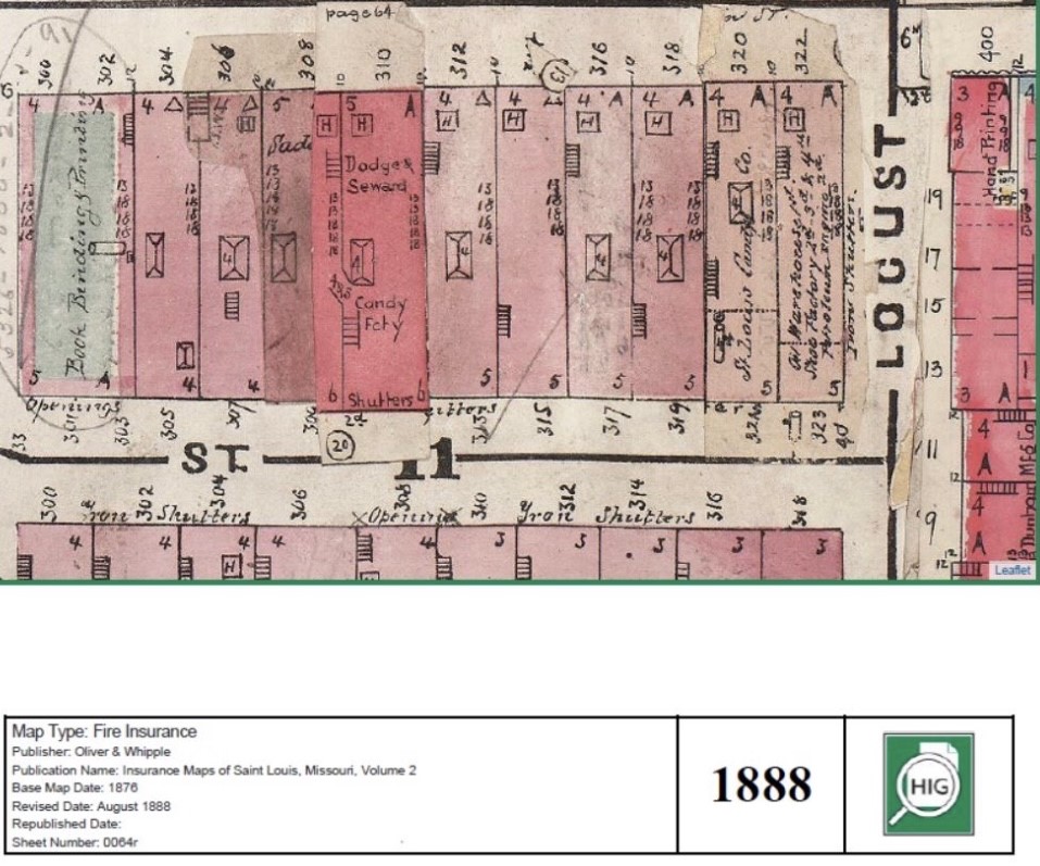
Saved map example: Oliver & Whipple, Insurance Maps of St. Louis, Missouri, Vol. 2, 1888. Accessed from FIMo.
Additionally, FIMo offers research tools for organizing, such as My Project Folder to collect maps to view, markup tools in the viewer, and the ability to save maps with notes.
As maps come into the public domain, they will be added. Almost all fire insurance maps should be in the public domain in the next few years, by 2027.