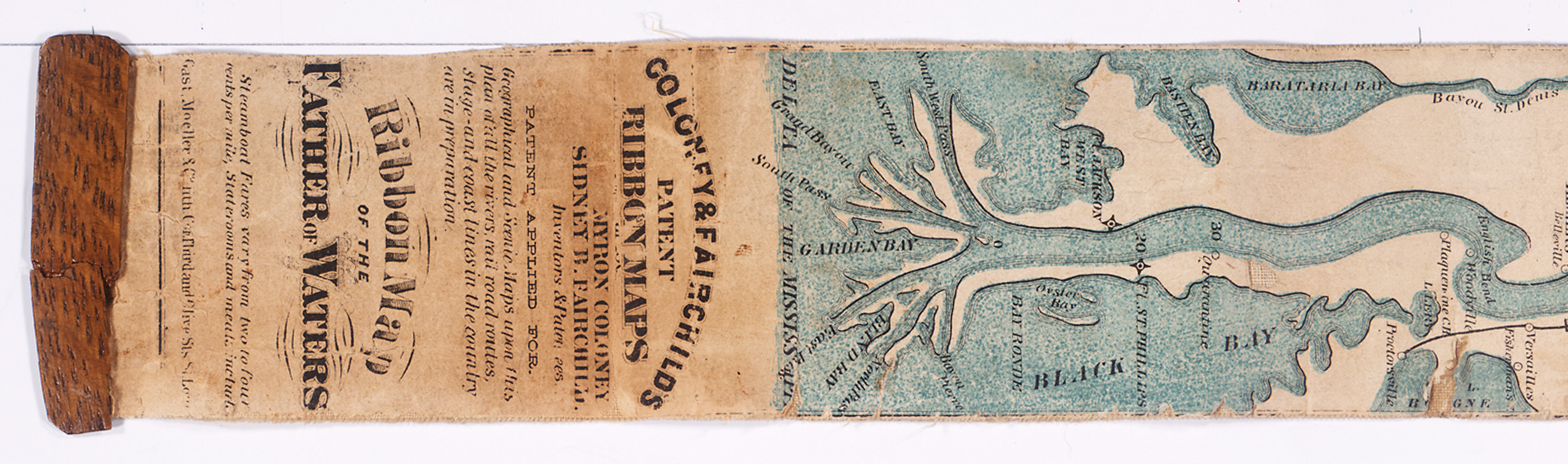
Ribbon Map of the Mississippi River from 1866
This is a digital presentation of a map whose length stretches to nearly 11 feet: The Ribbon Map of the Father of the Waters, published in St. Louis in 1866.
The linen-mounted Ribbon Map unrolls from a wooden cylinder in a strip about 2 inches wide by 129 inches long and shows plantations, towns, landings, and mileage points along the Mississippi as they existed just after the Civil War.